As planned, on April 1, 2015, we woke up in the South Palm
Beach Anchorage at 1:45, to leave at 2 AM. The other 4 boats, that we had talked
to but not yet seen, were planning to leave at 4 AM. We’d see them on the way or
catch up with them later. I had been up until about 11 the night before,
finishing a blog post and talking to family.
I dropped my phone hard in the cockpit, but it seemed to still work
fine. I was not well rested, but was up and excited to be going, finally.
At 2 AM, we got the engine on and the anchor up. It was still
dark, but there were lights on the west side of the harbor, where a lot of
industrial activity takes place. We had planned to get over to the channel on
the western side of the harbor and motor up and out. No way! We grounded in the
sandy bottom. Got off easily and hunted around in the dark for the exit. Didn’t
find it.
Decided to cross over to the east side, even though we had
avoided it earlier because we thought there was dredging going on there. The
east side provided a clear exit, and of course no dredging activity was
happening between 2 and 3 AM.
On our way out of the harbor, in the very dark, we suddenly
spotted a small pilot boat. On it, a woman advised us to “Stay to the north and
you’ll be fine.” What we didn’t realize until a few seconds later is that we
were being routed around an enormous ship behind her, on its way into the
harbor. This also told us that we needed to turn our AIS alarm back on!
Sometimes in harbors we have to shut it off, since it alerts us constantly that
we are on a course to run into another boat, because there are boats everywhere.
Once on again, the AIS started alerting us to something, but
it was very dark and hard to see anything. It was the breakwater! Clear. Soon
after, we heard another alert. This time it was the navigation light marking
the entrance to the harbor! Clear. Once out, we saw another huge ship, to the
north of us. A brief radio conversation confirmed that it was a dredge and not
moving yet.
Finally we were off! The lights of the Lake Worth inlet
harbor were visible for a long time. Now the moon was out and shone brightly
behind us. Because it was behind, it didn’t light our course at all, but did give
us a clear reference point. The seas were light, waves 1-2, maybe 3 feet at
most. Very much like we had experienced so many times in New England. The winds
were blowing about 14 kts, from behind, west. We put up the sails and kept the
motor on.
We like to sail with the motor running for many reasons. It
increases our speed. It keeps our batteries charged, which allows us to run our
electronics (chart plotter, auto pilot and other instruments). It allows us to
run the inverter so that we can heat food in the microwave, and charge phones
and other devices without draining the battery.
We also like to motor with the sails up. Sails stabilize the
boat and make the ride much smoother. And with an interior laden down with
canned goods, fresh fruit and other supplies, it’s best not to toss around. The
sails also make us more visible. Since one concern in crossing the Gulf Stream
is shipping traffic, we wanted to be as visible as possible. They would see us
on their instruments first, but actually spotting us (and not hitting us) is also
important.
We are motor sailors, or, as some have said “A sail assisted
power boat.”
We kept the main sail up, but soon gave up on the jib. With the
wind directly behind us, the jib just wasn’t helping. Early in the trip we had
great moonlight, but after a few hours the moon disappeared behind clouds. We
continued motor sailing in the dark for hours. Beginning about 5 AM, we tried
to hail our partner boats on the radio every ½ hour, but didn’t get a response.
Too far, out of range. Around 5:30 AM, we saw and heard two small fishing boats
communicating with each other. Almost no other boats or ships. No cruisers.
Our depth meter was registering “407 feet”. We later
realized it “sticks” on the last number it was able to measure. I’m not sure what its
limit is, but the depth in the Gulf Stream, on our path, is as deep as 719
meters, more like 2,373 feet (about ½ mile!). (So as some would say, we were never
more than a ½ mile from land!)
At 6:30 AM, we were 28 miles from FL, the half way
point! Later I realized that was only
half way to Memory Rock, which is just a rock, marking the western edge, or the beginning of the Little Bahama Bank. Sadly, that was still far from our destination.
We didn’t know what time to expect sunrise, but eventually
it began, while we were in the Gulf Stream.
 |
| 4202 – 4/1/15, 6:54 AM, Sunrise begins |
 |
| 4204 – 4/1/15, 7:10 AM, Pretty clouds, small waves. |
 |
| 4208 – 4/1/15, 7:17 AM, sunrise still in progress |
 |
| 4209 - 4/1/15, 7:19 AM – Sun still working hard to shine, through the clouds. |
 |
| 4210 - 4/1/15, 7:20 AM - waves abeam of us. |
 |
| 4212 – 4/1/15, 7:21 AM – “Red sky in the morning, Sailor take warning…” |
 |
| 4219 – 4/1/15, 7:28 AM – … Sailor take warning … of dark clouds ahead? |
 |
| 4222 – 4/1/15, 7:31 AM, view abeam (= on the side of us) |
 |
| 4224 – 4/1/15, 9:55 AM – Very tired, Captain Chuck hoisting the Q Flag. This is the Quarantine flag, required to be flown when entering a country, before checking in. |
By 11 AM, we reached Memory Rock, at the western edge of Little Bahama Bank. NOT the end of the trip!
 |
| 4227 – 4/1/15, 11:50 AM – On the Little Bahama Bank, we delighted in the light aqua color of the water! |
 |
| 4228 - 4/1/15, 11:56 AM – We were so proud of our Q Flag! We were actually about to check in to another country, for the first time, in our little boat!!! |
 |
| 4230 – 4/1/15, 12:50 PM, The captain is a little tired! Good thing we have "Otto" (the Autopilot), our 3rd, and most reliable crew member, to run the boat. |
 |
| 4232 – 4/1/15, 4:11 PM – Bypassing the first possible anchorage, at Mangrove Cay. (“Cay” is pronounced “key.”) I wanted to cry when we passed this anchorage, I was so tired! But it didn’t offer a lot of protection from the wind, so... |
 |
| 4233 – 4/1/15, 7:23 PM – … So we pressed on… |
 |
| 4234 - 4/1/15, 7:30 PM – ..And on. |
 |
| 4235 - 4/2/15, 6:49 AM – Great Sale Cay anchorage and surrounding area was stunningly beautiful in the calm morning. |
 |
| 4236 – 4/2/15, 6:49 AM – view of the exit from Great Sale Cay, so other-worldly beautiful. It was almost like we were on another planet. |
 |
| 4237 – 4/2/15, 6:50 AM – Great Sale Cay is a small, uninhabited island. |
 |
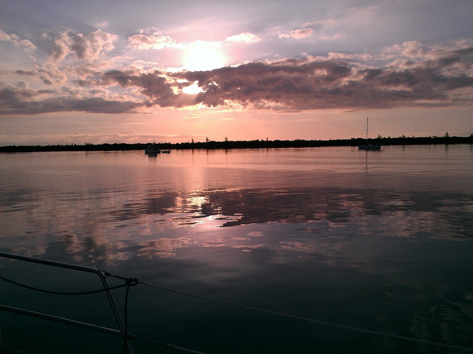
| 4238 - 4/2/15, 6:50 AM, Other boats in the anchorage in the early morning, with clouds reflecting on the water. |
 |
| 4239 - 4/2/15, 6:50 AM, the clear water is so inviting! We both swam in the morning. |
 |
| 4242 - 4/2/15, 6:51 AM Sunrise in the east, in the Great Sale Cay anchorage |
 |
| 4244, 4/2/15, 6:52 AM – sailboats leaving the anchorage, toward the west |
 |
| 4246, 4/2/15, 6:53 AM, Our Q Flag against the blue morning sky |
 |
| 4250 - 4/2/15, 7:46 AM – more boats ghosting out of the anchorage |
 |
| 4254 – 4/2/15, 9:53 AM - Swinging by “Jessie Ann” from Stuart FL before leaving, to say goodbye and thank them for info. Earlier I swam over to this boat to ask for any weather info. Forecast was “just like this” for the next few days. Perfect! |
 |
| 4260 – 4/2/15, 12:22 PM – In transit toward Green Turtle Cay. Notice my shadow on the bottom, through the clear water, as I took this photo. |
 |
| 4281 – 4/2/15, 4:03 PM, passing “Center of the World Rock,” a landmark. |
 |
| 4284, 4/2/15, 5:59 PM, we shared Crab Cay anchorage with only two other sailboats |
 |
| 4285, 4/2/15, 6:00 PM, Crab Cay, with our second neighbor boat |
 |
| 4286, 4/2/15, 6:00 PM, looking back at Crab Cay entrance |
 |
| 4288 - 4/3/15 - 6:43 AM, we also swam in the beautiful clear water at Crab Cay. The white spots are sand, among the grasses growing on the bottom, about 10 feet below. |
 |
| 4289 - 4/3/15, 6:43 AM, Leaving Crab Cay anchorage in the morning |
 |
| 4290, 4/3/15, 6:43 AM, Leaving Crab Cay, another calm day with only ripples on the water |
 |
4307 - 4/3/15, 10:04 AM, a cell tower, mocking us!! We still had no connectivity. Something was wrong! |
 |
4309 - 4/3/15, 11:09 AM, We later learned these were brush fires, on Little Abaco Island. The air smelled of smoke for about 2 weeks. |
 |
| 4317, 4/3/15, 1:03 PM, Approaching Green Turtle Cay |
 |
| 4320, 4/3/15, 1:07 PM, near the entrance to White Sound, Green Turtle Cay |
 |
| 4330, 4/3/15, 1:40 PM, in White Sound, Green Turtle Cay, with the Bolo water taxi. We anchored in White Sound. |
 |
| 4331 - 4/3/15, 2:51 PM, the first Bahamian I met, after 3 days in the country. When I asked him if he was Bahamian, he said "Yes, Ma'am." All Bahamians, including the children, are extremely polite. The children all said "Good Night Ma'am" as I walked by in the evening. |
 |
| 4332 - 4/3/15, 2:52 PM, on the way to Customs, on Green Turtle Cay. Can you tell from the "STOP" that they drive on the left? |
 |
| 4333, 4/3/15, 2:52 PM, on the way to customs, passing the “Down Through Liquor Store” (yellow building on the right) |
 |
| 4335, 4/3/15, 3:00 PM, Meeting with the Customs officer at Green Turtle Cay. We weren’t sure if we’d be able to check in on Good Friday, but it turns out Customs is open every day, even holidays. |
 |
| 4337 – 4/3/15 – Customs office, Post Office, Public Restrooms, and a Phone Booth |
 |
| 4336 - 4/3/15, 3:48 – lining up our plans for the weekend |
 |
| 4340 - 4/3/15, 3:49 PM – Heading back to the “Down Through Liquor Store” one of many places to purchase cell phone minutes. |
The “kiosk” reminded me of college. Back in the days before
electronic communications, this was the only way to learn what was happening on
campus!
 |
| 4341 – 4/3/15, 3:49 PM - Another notice for the Grill Out, scheduled for the next day. (Yes, we went. The food was terrific!) |
 |
| 4242 – 4/3/15, 3:59 – At the Down Through Liquor Store, she is the liquor storekeeper, bar tender, and seller of phone minutes. |
Another cruising couple had given me a Bahamas Phone in Vero
Beach, upon their return from the Bahamas. It had a little time left on it but
not enough to make a call to the US. I had no idea how to add minutes to the
phone. Turns out it’s easy, just go to the liquor store!
I wanted desperately to call my mother to let her know I was
OK, because I had promised to call when I got to the Bahamas. When I made the
promise, I expected to call later in the day on 4/1/15. Little did I know that
it would take another 2 days before I could even try. I was very concerned that
my mother would be worried about us. When I finally reached her, I discovered
that she wasn’t worried at all. Maybe she didn’t realize that we were sailing
in the Atlantic Ocean, across the Gulf Stream. Or maybe she forgot that I said
I’d call. Oh well! She was still happy to hear from us.
 |
| 4343 - 4/3/15, 4:17 PM – our last stop was at MacIntosh Restaurant to buy Coconut Bread and Rum Cake. Yummy! |
 |
| 4361, 4/3/15, 5:19 PM – Hoisting the Bahamas Flag, at long last! |
on s/v Summer Wind
Double click on photos to see a larger
view.
Now you can sign up to receive email when a new post is loaded. See the column on the right.
Note that I'm
backfilling with pieces that I didn't get to write while we were living them.
So please keep reviewing the contents list to make sure you've seen everything.
I change the "posted" dates so posts remain in chronological order.
No comments:
Post a Comment